SITE SELECTION
In the face of a rapidly changing climate, cultures, ecologies, and natural processes are becoming increasingly fragile. Specific issues of water scarcity and cultural preservation must be addressed immediately and creatively if we are to sustain certain ways of life as we know it. Resource exchange across coastal boundaries becomes critical to issues of sustainability.
Islands have a particular relationship to shorelines in that they are encompassed completely by the context of water at a perceivable scale. On an island, water both literally and metaphorically surrounds, and even transcends, culture. On an island, water frames all natural processes and defines specific ecologies. Both culture and natural processes themselves become fluid as they are constantly shifting, dissolving, fluxing, moving, and changing.
The context for this project is the local watershed of Narragansett Bay and Prudence Island at its center. My project focuses on a series of abandoned bunkers and active wetlands on a former United States Naval Base at the southern end of Prudence Island.
CHIPPAQUASETT: EARLY SETTLEMENT
Chippaquasett, or Prudence Island, is situated at the center of Narragansett Bay, stretches a narrow seven miles by just over one mile at its widest point, and totals approximately 3800 acres. The northern end of Prudence is primarily sand and gravel glacier deposits while the main body of the island is a rocky spine with a thin soil layer. (Croasdale, 59) The earliest record of settlement on Prudence Island was by the Wampanoags, who were succeeded by the Narragansetts when an epidemic decimated their population. In 1637, the Narragansetts gave Chippaquasett to Roger Williams as a “token of friendship,” which he then renamed Prudence. (Curran, 1) Williams then divided the island with Governor John Winthrop of the Massachusetts Bay Colony. The original stone wall that delineated their properties still stands. Property on the island turned over frequently in the seventeenth century, with the first arrival of tenant farmers and real settlement being founded in 1659.
“The early farms on Prudence, were, in general, similar to the farms elsewhere in the colony. The early islanders seemed to be specialists in raising sheep. The principal source of their income was from the sale of wool, flax, help, cattle, fruit, and produce. The pastures seemed well adapted for sheep raising. A quantity of tobacco was grown, they also had peach, plum, apple and pear orchards. Large quantities of Indian corn were harvested, they mixed the corn with rye to bake their bread. The corn was also fed to their poultry, cattle and swine. The salt hay which grew in large areas at Nag Creek and the marsh at Pine Hill Creek was extremely useful for packing, thatching etc. Every farm had at least one or two oxen, also horses and cows. In checking some of the wills of the early islanders, many farm implements are listed, among them scythes for cutting hay and grain. The supply of shellfish and sea food was practically unlimited. From all appearances, the early farms were decidedly self-supporting an needed very little assistance, if any, from the mainland.” (Maytum, 47)
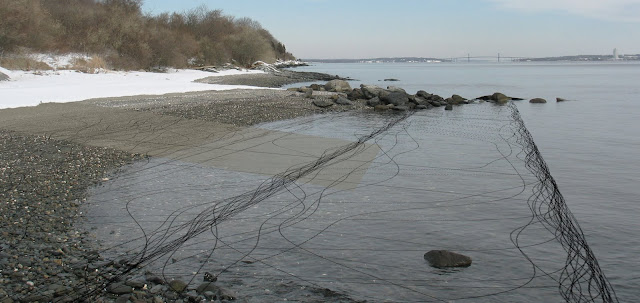
In 1747, Portsmouth annexed Prudence Island. In the mid-eighteenth century travel to and from Prudence increased and several wharves were built. “The South Ferry Wharf, more often called Pearce’s Ferry Wharf, was located on the southeastern shore of the island not very far from the extreme south end. There was a road connecting with this wharf. Nathaniel Pearce, who lived at the south end, operated this ferry when it began and for a few years following. This wharf is shown on the various early maps. The remains of the wooden piling can still be seen. It was built either in December of 1742 or early 1743.” (Maytum, 111)
The British visited, raided, and were driven from Prudence on various dates from 1775-77. The objects of their raids included food, forage and lumber. One particular raid in 1776 resulted in depleting the island’s population to half of what it had been (111 from 228.) (Curran, 1)
PRUDENCE ISLAND: MAPPINGS
This series of maps of Prudence Island, ranging from mid-eighteenth century to modern times, illustrate the changing cultural interpretations of the island. Although political boundaries changed over time, traces of the initial divisions of the island, which occurred under the guidance of Rodger Williams and Governor Winthrop, can be perceived even in contemporary maps. Unfortunately no mappings exist from the time of the Wampanoag or Narragansett inhabitation of Chippaquasett.
 Le Rouge, Map of Prudence Island, 1750.
 Charles Blaskowitz, Topographical Chart of the Bay of Narragansett, 1777.
 Francis Curran, Prudence Island circa 1895, 1970.
 Town of Portsmouth, Portsmouth Plat Map, 2002.
 RIDEM, Groundwater Classification for the Bristol & Prudence Quadrangles, 2005.
PRUDENCE ISLAND: RECENT HISTORY
In the nineteenth century, Prudence became a popular summer resort, with the settlement of Prudence Park and construction of the Stone Wharf on the west side of the island which was a stop for steamboats. The wooden wharf of the Wilson Oil Works, constructed in 1870, was situated on the extreme southeastern shore of the island and was generally spoken of as the “fish pier wharf” or “fish works wharf.” (Maytum, 166) At this point in time, farmland was also extremely productive, with 11 farms on Prudence in 1880 totaling over 3,500 acres.
In 1942 the United States Navy acquired a 600 tract on the south end of Prudence Island which was used as a storage depot during World War II. The Navy built a large wooden wharf, known at the “T Wharf,” on the east shore at the extreme southern end of the island at the time of their initial occupation. A series of somewhere between twenty-nine and thirty-nine bunkers were constructed by the Navy during their occupation, along with an extensive network of roads. The site is now park land which was acquired through the Federal Lands to Parks Program of the National Park Service for use by the general public.
In 1980 the Narragansett Bay National Estuarine Research Reserve was established. It is part of a network of twenty seven reserves throughout the country created to protect areas through the Coastal Zone Management Act in 1972 by the National Oceanic and Atmospheric Administration. As part of NERRA, which is “dedicated to the protection, understanding, and science-based management of our nation’s estuaries and coasts,” the reserve has been set aside for research, education, passive recreation, resource protection, and sustainable resource use. (NERRA and Croasdale, 61) NBNERR was expanded in 1993 and includes over 2300 acres on Prudence, Patience and Hope islands as well as 2500 acres of water adjoining the islands out to a depth of 18 feet. Sixty two percent of Prudence Island falls under the federally designation of NBNERR. The South Prudence Tract of NBNERR occupies the former Navy site.
Today, the agricultural traditions of Prudence Island have practically vanished, with only one commercial farm and one community garden in production.
PRUDENCE ISLAND: FRAMED WITHIN THE 21st CENTURY
Many of the cultural traditions and features developed along the coast of Prudence Island during the twentieth century will become active elements in my study and proposal of how to engage the dynamic edge. The infrastructure of wharves and docks as well as the Navy’s bunker structures may serve as specific sites for engagement of the coastal edge. It is my hope that the cultural heritage of resort or recreation as well as agriculture can be restored in the twenty-first century as means to create a more sustainable and dynamic culture on Prudence Island.
