I feel I exist on the boundaries
Somewhere between science and art / art and architecture / public and private / east and west
I am always trying to find a balance between these opposing forces, / finding the place where opposites meet.
Water out of stone / glass that flows like water / the fluidity of a rock / stopping time
Existing not on either side / but on the line that divides / and that line takes on a dimensionality / it takes on a sense of place and shape.
-Maya Lin, Boundaries
CONCEPTUAL PRECEDENTS
While exploring the ideas of edge and boundary during my initial conceptual studies the image of Oliveira’s evocative, abstract Edge paired with Maya Lin’s writing were of great influence to the development of my work. Many of the questions posed during that phase emerged as a reaction to Lin’s discussion of boundaries, specifically to the idea of a line or edge taking on a dimensionality that speaks to a sense of place. As my studies shifted to explore the subsequent term of frame and how my understanding of frame might materialize on site, Sugimoto’s photographs of drive-ins and Reis’ installation artifacts focused my conceptual ideas into design thinking. After this initial gathering of edge and frame precedents, an expanded search of landscape precedents was engaged, defined by the terms of fluidity, natural processes, and terrain in addition to frame and edge. Through the process of exploring landscapes and projects from the perspective of particular terms, relationships between the terms arise and in many cases become inextricably linked.
 Nathan Oliveira, Edge
 Hiroshi Sugimoto, South Bay Drive-In
 Mario Reis, Natural Watercolors
FLUID
The design of the Diana Memorial employs the malleable quality of water to evoke a range of energy and emotion. The character of the fountain shifts according to the speed and surface tension of water in each portion of its fluctuating path. Water initially bubbles up from a fountain and is diverted in two directions according to the topography of the site. To the east it follows a choreography of cascading over textured steps, gently rocking and rolling along a subtle curve, and then gaining momentum as it enters another curve where jets pattern the surface of the water. To the west, water flows within a lively simulation of a mountain stream, travels into a widening channel where bubbles are introduced, tumbles over a waterfall, and spills through a chaddar (a traditional Mughal garden water feature created by water flowing over an elaborately carved stone.) The eastern and western paths meet in a reflective basin where the water is then pumped back to the source fountain to create an unending cycle.


NATURAL PROCESSES
By inserting built structure into a context of natural processes the High-Tide Pools are able to utilize the periodic rise and fall of tides to create moments of pause within a greater system of flows. Just as natural tide pools fill through channels between rocks or rising over the incline of the shoreline, this construction uses apertures in the pool walls to allow water to infiltrate the pool area. As the tide ebbs, the pool reacts by slowly emptying via gravity through an artificial subterranean passage. Existing dynamic conditions have successfully been activated to facilitate recreation particular to a particular time and place.


Anne Lacaton + Jordi Bernado, High-Tide Pools
EDGE
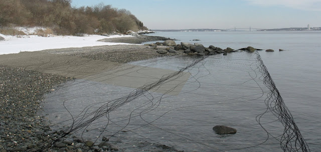
Tom Leader observes the California coast as an interaction between two systems of alignments, each comprised of natural and cultural elements. The north-south system consists of fault lines, mountains, and shorelines as well as rail lines, freeways, and street grids. The east-west system includes wind, fog, tides, migrations, city and state jurisdictions and marginal communities that lack clearly defines forms and boundaries. When these opposing directional flows intersect and collide the result is what the project refers to as a broadly corrugated landscape that heightens one’s awareness of both systems.
The installation of parallel screens traced four specific north-south lines: a railroad track, the original shoreline, a frontage road, and the edge of a landfill. The screens were then filled with both organic and artificial materials that accumulated from the flow of the east-west systems as they intersected the north-south lines. As these collected materials inhabited their new north-south orientation they continued to shift in response to the effects of the east-west phenomena.


FRAME
The River Park maps a seasonal experience of water along a path by creating a setting that references the unique character of each time of year. From the top, in winter water is understood to be dark, still and sad; in autumn water is hazy, stagnant, melancholy and quiet; in summer water is transparent, light, vivid and whispering; and in spring water is fresh, clear, cheerful and rippling. Multiple forms are used in each construction to frame the season’s character in regard to how the water is held (pool), how the site is traversed (path), and what the boundaries of the space are (wall).

Kostas Manolidis, A River Park in Veria
TERRAIN
Maya Lin engages a process that uses scientific and topologic tools to explore traditionally inaccessible landscapes in which the relationship between analytic study and gestural form is fundamental. With Blue Lake Pass (lower) Lin shifts the conventional understanding of terrain by turning sections of topography on their side and exploding a gridded landscape into a traversable space. In this way ones perspective of the land shifts dramatically. The ground is no longer a single plane but a deep, rich, grounded form. A new perception of terrain is also framed in Water Line (center) which is meant to be experienced from both above and below. Water Line maps the topography an existing ocean floor in order to bring attention to what lies below what covers the majority of the earth’s surface. Bodies of Water (top) in the same regard illustrates the volume of a particular sea below the boundary of the water’s surface.


Maya Lin, Systematic Landscapes
This investigation of precedents revealed a range in both spatial and temporal scales: in spatial scale and typology from gallery installation to multiple acres of a park; and in temporal scale from a condition that may be observed for only a moment or something that is frozen in time. These precedents also give tangible qualities to the conceptual terms of fluid, natural processes, edge, frame and terrain. By using precedents as a lens through which to view the conceptual terms of fluid, natural processes, edge, frame and terrain across a range of scales they have the ability to become site specific.
